Building & Construction
We've worked across more than 100 construction sites, surveyed countless roofs, measured numerous stockpiles and conducted land level surveys, and mapping projects over time.
We have the skills and expertise to get the job done. On time, on budget and to the very highest standards.

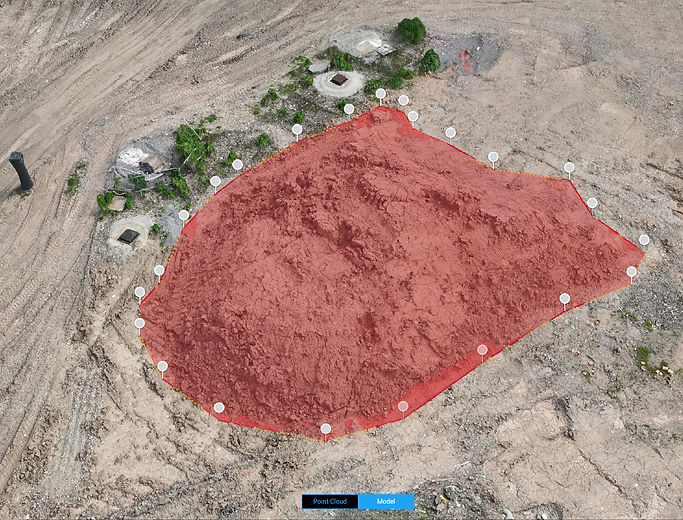
Stockpile Volume Measurements
Using RTK drones we offer highly accurate, efficient, and safe solutions for measuring and managing site material volumes. Our volumetric measurements eliminate the need for manual surveys, significantly reducing the risk to people and saving valuable time. The data collected can be quickly processed and results shared allowing for real-time decision-making and enhanced operational efficiency. Whether for routine inventory checks or comprehensive site audits, our drone stockpile measurements service delivers reliable and cost-effective solutions tailored to meet your specific needs.


Site Updates & Monitoring
Our drone construction site updates and monitoring services leverage state-of-the-art aerial photography and video technology to provide comprehensive, real-time insights into project progress. By capturing high-resolution images and detailed videos from various angles, drones can document every phase of construction with unmatched precision and clarity. These services enable stakeholders to remotely monitor site conditions, verify compliance with safety standards, and track the completion of tasks against project timelines. Regular drone flyovers create an ongoing visual record, facilitating communication among project managers, contractors and clients. This innovative approach not only enhances transparency and accountability but also helps identify and address potential issues early, ensuring projects stay on schedule and within budget. Whether for weekly or monthly updates or critical milestone reviews, our drone monitoring services offer a powerful tool for modern construction management.
Aerial Surveys & Inspection
Our drone survey and inspection services provide cutting-edge solutions for accurately and safely assessing various sites and structures. Equipped with high-resolution cameras and advanced sensors, our drones can quickly capture detailed images and data form hard-to-reach areas, reducing the need for manual inspections and minimising risk to staff. These services are ideal for sites, land, infrastructure and roofs, offering precise mapping, condition monitoring and reporting. By delivering real-time insights and thorough visual documentation, drone surveys and inspections enhance operational efficiency, safety and decision-making processes.

